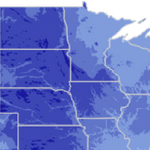
Connecting animated curved lines in HTML5 interactive maps between several destination points offers the possibility to display how information is linked. Even more important is the ability to show the directional flow of this data along the line, conveying where the information starts and ends.
jQueryMaps can now show animation along any line, whether linear or curved. Animation can vary from an icon, such as a plane or vehicle to directional symbols or expanding lines. This is a great resource for illustrating the flow of data from multiple locations and the direction in which the information is moving with animated curved lines.
See how this feature was implemented for a client in the airline industry.

Animated Curved Lines in HTML5 Interactive Maps

Any question about our
interactive maps?
We will be very happy to assist you personally at 1-866-392-0071 or via email.
Success! Your request has been received and will be answered promptly.
Oops! Something is wrong, maybe double checking your email or the sum will help.


