A common application for online jQueryHTML5 maps is to organize and maintain custom territory divisions so that updates are immediate and visible to all agents. In order for changes to be implemented swiftly, the system would need to be centralized and uploaded to a server so that all users with access and an internet connection can connect to the map. The alternative and outdated approach is to keep different copies of the map stored locally on separate computers. For ease of maintenance and accuracy of data, server-based solutions are the way to go. See what jQueryMaps has to offer.
The first topic to consider is when should a company consider investing in a territory map. In most cases this becomes an important concern when sales activity is broader than a single State and agents can cover multiple States. A list could work if a company does business in a single State or in a region where each State has a specific agent, however once these lines expand, the benefits of using a territory map to organize the information is well worth the investment.
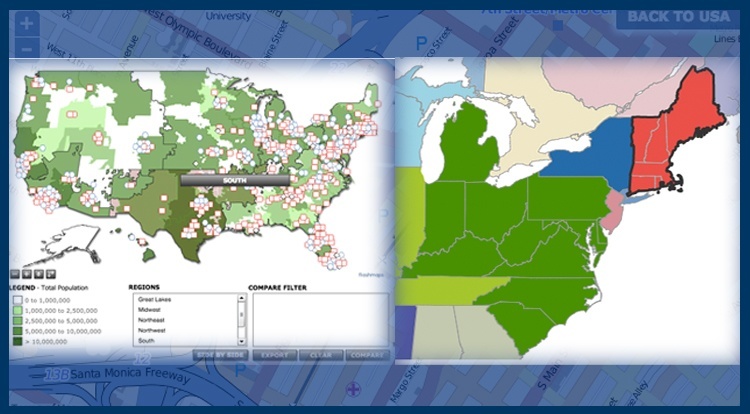
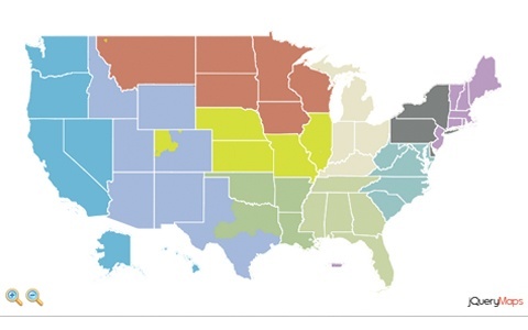
Territory maps normally fall into one of two groups. The first is a straightforward project where territories align with common administrative areas such as States or Counties. See example. The map is linked to a back-end database, which colors areas according to the agent category associated with the group of States. For example, if agent A works in the Northeast, the States of MA, NH, VT, RI would be assigned to his/her category and display in a predetermined color. Hovering over any of the areas would provide you with information specific to this agent, such as contact details, sales goals, real-time results or any other data that is being collected for the project. The second scenario is slightly more complex, but more realistic for many industries. When sales territories don’t align with States or Counties, at jQueryMaps we normally use Zip Code 5 divisions or Counties to create categories. Each agent is assigned a series of zip codes in a database, and the application loads to show all of the zip codes in respective colors from the national view. This is very useful for mapping territories that are specific to a company or industry that are prone to change frequently, such as the demo created for ThinkIPA.

Industry custom division map
Agent territory maps can either be hardcoded into the cartography as was the case for the ParkInteractive map (see PIKE example) or generated based on database information (see Think IPA example). For projects where the content is fairly structured and unlikely to change often, the hardcoded approach offers great style hover-over effects and sub-layer navigation to each division. In many other cases, the appeal to using HTML5 Maps is the ability to maintain custom territory divisions through a database. This flexible approach allows administrators of the project, to easily assign new areas to any agent and the information is immediately updated on the map. For companies managing shifting territory lines this is certainly the route that should be take. For smaller territories that require street-level detail, see our past blog article on creating overlays within OSM.
When maintaining the custom territory maps, updates can either be handled in the database directly or managed through an admin interface. Working with an admin provides several benefits for companies. The primary consideration is the fact that the admin opens the possibility to non-technical staff assisting in the maintenance of the map. This can be members of the sales team directly or project managers that can use the admin to perform a predetermined set of functions without risking accidentally eliminating any of the information to the project. The admin also can improve the efficiency of maintaining the custom territory divisions when working with large amounts of data. If your territories are created through groups of Counties or Zip Codes, the admin can organize the area list by State or Agent to quickly update content. With a few clicks of the button and once stored, the content of the map can be quickly changed.
If you work with custom territories and would like to provide a portal for managers and agents to view content, strongly consider using a server-based map. See jQueryMaps showcase for more examples of HTML5 mapping solutions used to define custom territory divisions that account for the flexibility, accuracy and management demands of any company. Setup a free consultation for more information.
Share the post "Using HTML5 Maps to Manage Territories and Custom Divisions"


