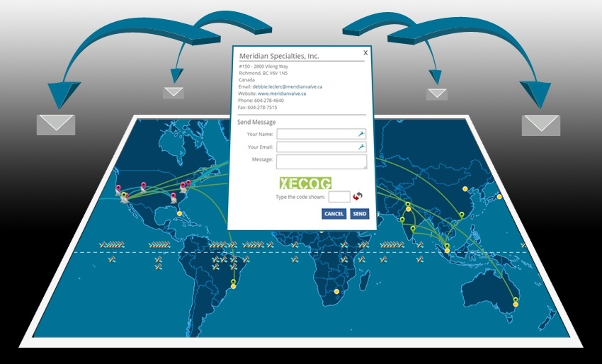
In this article we will discuss how an interactive US map can serve as a tool to display forms that can be easily filled in and emailed by any map visitors. This solution was requested by several clients seeking to deploy maps as a way of engaging client participation and in all cases the underlying theme required that data be inserted into fields within an embedded pop-up box form. The information would then be stored and emailed to a predetermined email address, specific for each location. This tool enhances any dynamic mapping project and increases efficiency. Users can directly submit information without needing to open third party email editing software or navigate to different pages. In addition to increasing visitor retention to the site, this also favors client participation and the likelihood of receiving spontaneous feedback for the end client. The general rule of thumb that simplicity is better holds true in this case.
How Data Forms can Work within JavaScript Maps
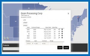 Forms offer a quick method of gathering public information and processing the feedback for later analysis. The questions and specific fields often have limited response options, and many elements can be arranged in drop down boxes to offer a predetermined response structure. When forms are used as part of a mapping solution, the responses will also include the geographic area or icon through which it was submitted. This is an important feature of embedding forms within the pop-up boxes of interactive maps as the tool filters the area of interest in the first click of the map. In all of the information provided below, it is important to keep in mind that all forms are unique and can be designed according to your specific needs. We will discuss the following features in today’s article.
- Who Benefits from using Forms Within a US States Map
- Dynamic Maps and Using Dynamic Content within Forms (different regions have different info)
- Designating Receiver and Personalizing Subjects Based on Area of US Map Selected
- Additional Features and Spam Security within JavaScript Maps
Forms can be active and displayed initially, or called once a button is selected. This decision varies and often depend on how important receiving a response is to the end client. If the pop-up box offers a useful and efficient way to communicate through an interactive US map, then perhaps the form itself would be hidden behind a contact us button. However there are many cases for showing the fields directly when visitors click on an icon or geographic area.
The Power of Using Forms to Communicate with Viewers of your Interactive Maps
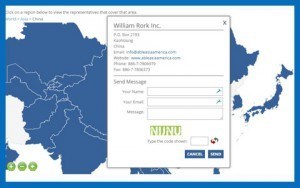 There are many applications for inserting forms in a website. In general the goal is to encourage viewer participation, registration or feedback.The first example we will discuss is a sales rep territory look up map, in which visitors are presented with a world map with countries activated based upon where reps are located. When a user clicks on any active Country, the map navigates to said area providing a nice zoom transition and immediately displays a pop-up box with general information about the rep and fields to fill in to email the same contact. This feature provides an immediate way to email sales reps without copy pasting links, navigating to different pages or opening email editing software. The email and message are sent instantly from within the pop-up box form. In addition, the subject of the email automatically carries information about the world map location selected to help categorize incoming emails. The company can also assign cc destinations and potentially bcc contacts for each email sent through the form. See a recent example dynamic form on an interactive world map.
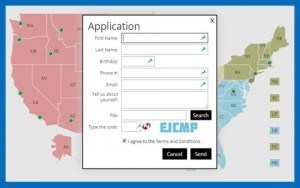 The second example we will look at involves client registration by enabling applying for a position directly with the pop-up form. In this scenario the interactive US map displays cities where positions are open and need to be filled. Users can easily click on any cities to see information about the position available and submit their contact information within seconds. In this case the fields are fairly standard, but the software also allows for users to quickly upload a pdf or Word file for attaching their resume to the outgoing email. The ability to upload and attached content to the email submission is a fantastic feature that simplifies the end user interaction with the page. As described prior, the email, subject, cc and bcc fields can all be assigned and personalized according to the specific location selected. See example
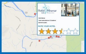 The final example that we will mention is a quick review tool. This can apply to tourism related sites or any project that would like gauge how their clients feel about a particular location or geographic area. Imagine being able to list multiple hotels within a city street map and encourage registered users to submit their reviews. The reviews could be posted to the general public and filtered by the website management team. The actual rating process can be handled through a simple form included in any dynamic map and all questions can be tailored to the region and category of the hotel. Keep in mind that tourism is just one example, and user rating on feedback is a fundamental value for any service providing company.
Displaying Questions Based Selections within an Interactive US Map with Cities
One important consideration is that the fields displayed within the form do not have to necessarily be the same for all locations and regions. As such, multiple configurations of the form can be developed and depending upon which city has been selected, or which Country in the World, specific questions are posed to the user. This situation may become relevant with World interactive maps displaying contact information by products. Perhaps the products offered in one region are not the same as another, and as such the informational fields within the form on which a user is inquiring should be dynamic and adjust accordingly. This important features makes for a highly robust and flexible tool. The same is true for icons within a Country (usually cities). Users that select on cities in the West coast may be displayed different information than users which clicked on other areas of the Country. Therefore the structure of the pop-up form and the specific questions can vary based upon the region selected and the specific icons selected.
Easily Assign Destination emails Delivered through any HTML5 Map Form
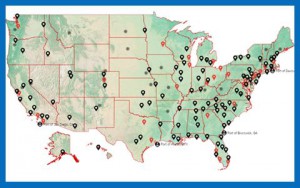 As mentioned in the paragraphs above, there is a significant amount of flexibility for managing who receives any email send through a pop-up box form. The recipient parties of any submitted form can be universal to all locations on the map or specific based on select US Cities or World Cities selected on the map. All fields of the email can also be personalized to assign CC emails and BCC fields where appropriate. This would normally not be visible to the user filling in the form, but provides an excellent way for teams to stay on top of new content being submitted through any forms integrated with an interactive US map. Inquiries about sales or availability for a product can be delivered to the primary sales rep for the region, but also delivered to alternative email groups within the company. This means that general sales teams, individual sales reps and the overall company can stay abreast of the most recent leads created through the custom map forms embedded within the pop-up boxes. With the purchase of a similar solution, you will receive all of the code to later make changes on your end directly, including the XML files and CSS to stylize the pop-up or even link new fields to a database. For a non-technical approach, consider a simple admin tool to manage forms and their design. See recent blog article.
Powerful Forms Work to Make even More Powerful Interactive US Maps
There are many reasons why a map project may want to include a form. In most instances maps are designed to project information to the user within an interactive map interface, however using intuitive embedded forms also gives the users the opportunity to interact with the company directly. Forms are highly customized and can be configured to display either when locations are selected, such an interactive US map with cities, or areas, such as Countries on a World Map. See link. The fields themselves can vary and the structure of the form can shift according to which area has been selected, providing Companies with a powerful tool that addresses changes in business and production around the World. When content is entered into the forms and submitted, including the option to upload and instantly attach pdfs and Word documents, the recipients of the email can be assigned on the back end. The tool supports including content in the subject line and filling a cc and bcc field for the email according to the area selected. Include forms in your next project to engage your website visitors, encourage participation and keep traffic on your site using our interactive mapping software. Contact us for a free consultation to learn more!
Share the post "How an Interactive US Map with a Data Entry Form Improves Efficiency"

